Menu
Log in
Log in

HAVELOCK CHAMBER OF COMMERCE

Supporting Local and Buying Local

Points of Interest

Explore the Havelock Belmont Methuen Township Area

The Township of Havelock Belmont Methuen is located 2 hours east of Toronto and 2.5 hours west of Ottawa. Being located on the southern edge of the Canadian Shield, the surrounding countryside offers fantastic scenery all year around. Remember to bring a camera and film to capture the wonders of nature and all your memories.

In the summer explore the lakes situated just a few miles north of Highway # 7. Explore the Trent River system which is just two miles south of Highway # 7.

Enjoy the autumn colours. Travel the county and township roads, especially north of Highway # 7 into the Canadian Shield. Walleye and smallmouth and largemouth bass vary in abundance in Round, Belmont, Oak, Kasshabog, and Jack Lakes. A dedicated muskie angler can anticipate catches in the 10- to 20-pound range (4.5- to 9 kg) from Round, Kasshabog, and Jack Lakes, especially in the fall.

Snowmobile the groomed trails. For trail information contact the Havelock District Snowmobile Club.

Check out the rushing springtime water runoff at the local bridges and dams which dot our countryside.

Here are some scenic locations which you may wish to spend a little time exploring:

Mathison Conservation Area

Mathison Conservation Area

The Mathison Property is a 250 acre natural area of scenic forests and wetlands located north of the Village of Havelock. There are a number of shorter hiking and walking trails, none over 1 km.  The trails have recently been restored and no longer allow atv usage. Bylaw No. 2021-022 was passed on April 6, 2021 prohibiting the use of all Off-Road Vehicles (ORVs) within the property to preserve the natural beauty of the acreage, and to avoid damage to the walking trails. This property was graciously donated to the Township by John Mathison in 2001 for conservation, education and recreation purposes.

Link to trail map:

https://www.hbmtwp.ca/en/play-and-discover/resources/Documents/Mathison-Property-Map.pdf
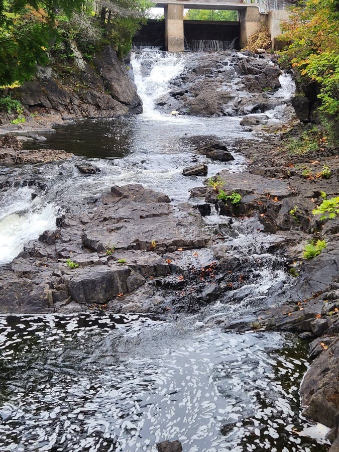

Cordova Lake Stock Photos - Free & Royalty-Free Stock Photos from ...

Cordova Lake Dam

  • Located at the south end of Cordova Lake. Going East on Hwy. #7 about 10 km past Havelock, turn left on to Belmont Twp Second Line. Follow this road north and continue north as the road merges to Peterborough Rd 48. Drive for about 5 minutes until you reach Preston Rd, just as Peterborough Rd 48 bends to the left. Turn left on Preston Rd, and then turn right on Fire Route 18. Follow Fire Route 18 north for about 3 km and you will come to a parking area in a clearing, quite close to the southern end of Cordova Lake.
  • Listen to the water thrashing off of the rock riverbed below.
  • A large circular wooden flume carries water to a small nearby hydro generating building (the green roof). Walk down the narrow road to it.
  • Read about Cordova Gold Mines. Inc.

Crowe Bridge Conservation Area (Trent Hills) - All You Need to Know ...

Crowe Bridge Conservation Area

  • Owned by the local Crowe Valley Conservation Authority.
  • Day-use permits are available. Great swimming in the shallow, limestone-based riverbed.
  • Mini golf course, picnic tables, outside toilets and a nearby snack bar.
  • For more information visit their website.

Fishing/Boating

  • Choose one of our inland lakes for a day or a few hours of fishing.
  • Most lakes have large and smallmouth bass, walleye, muskie, perch and sunfish.
  • There is a public boat launch on most of the lakes.
  • See our Chamber business directory for businesses offering boat rentals, bait or accommodations.

The Gut Conservation Area (Apsley) - All You Need to Know Before You Go ...

The Gut

  • Land owned by the local Crowe Valley Conservation Authority. Located 11km east of the town of Apsley and to the south of Coe Hill
  • The Gut Conservation Area is 400 acres of Ontario’s rugged natural splendor.
  • From the parking lot, nature trails lead through hardwood forest to a viewing area where the Crowe River has cut into the bedrock, creating a vertical rock gorge.
  • Very scenic. Some picnic tables, no swimming.
  • Day use, no camping facilities.
  • Short hiking trails.
  • Unsupervised location, no fees.

Kasshabog Lake Park

  • Maintained by the local municipality of Havelock Belmont Methuen.
  • Excellent sandy beach, picnic tables, outside toilets.
  • Public boat launch, good parking.
  • Small library open during the summer months.
  • No Park fees.
  • Day use, no camping facilities.
  • For More Info

Belmont Lake

  • Public boat launch offered at the end of Mile of Memory Road on the east side of the lake.

Round Lake

  • Public boat launch offered on Round Lake road on the east side of the lake.
  • Also a public boat launch offered at the end of Anderson Road on the north side of the lake.

West Twin Lake

  • Small public boat launch offered on the Peterborough County Road 46 adjacent to Fire Road #74.

Municipal Playground Park Locations

In Havelock on George Street beside the ball diamond/arena. — Swings, slides teeter-totters, climbers.

In Havelock just south of Hwy. #7 traffic lights. — Swings, slides, teeter-totters, tennis court.

Hamlet of Cordova Mines. — Various playground equipment.

Rotary Club of Havelock Park. — At the east end of Havelock, enter from Industrial Drive. The Park is adjacent to Plato Creek. Picnic tables, short walking trail south of Miniature Dam.

Soccer Fields – At the end end of Havelock, south of the railway track, turn west on to Industrial Drive. Soccer fields at the end of the street.


Petroglyphs Provincial Park is where to find emerald lakes and ancient ...

Petroglyphs

  • A Parks Ontario historical site. No trip to our area would be complete without visiting the Indian rock carvings.
  • Supervised interpreted viewing sessions during the summer months.
  • Park offers hiking trails for the novice and serious backpacker.
  • Very good chance of seeing deer in their natural habitat.
  • A Park entrance fee applies.
  • Website

Trent River System


Healey Falls | Waterfalls Ontario | Where is Healey Falls

Healey Falls Lock/Dam

  • A great location to watch the boats go through a lock system.
  • Fish from the banks of the Canal.
  • Walk across the long concrete dam to the east side of the river and explore the limestone waterfall shelf.
  • The picturesque falls are especially spectacular in the spring or whenever there are high river flows.

Hamlet of Trent River

  • Fish from the concrete piers under the newer concrete bridge, adjacent the public boat launch.
  • Enter the Hamlet of Trent River on the eastern side of the river, cross the old iron bridge and there is a small parkette on the right; a place to watch the yachts go by.


Featured Business

Powered by Wild Apricot Membership Software